1: Residential Stormwater Management System
Explore this comprehensive stormwater management system plan, designed for a residential single lot. Created using AutoCAD Civil 3D, this project ensures efficient water drainage and environmental sustainability.
2: Road Design in AutoCAD Civil 3d
Discover this detailed road design project created for a USA-based client. Designed using AutoCAD Civil 3D, this plan includes alignments, profiles, and corridor modeling for smooth and efficient road infrastructure. The design ensures compliance with local regulations and enhances traffic flow and safety for residential development.
3: Proposed Subdivision Plan with Grading and Drainage
This proposed subdivision plan integrates precise grading and drainage solutions for optimal land development. Crafted using Civil 3D, the design focuses on effective stormwater management, proper drainage flow, and terrain adjustments to maximize land use and minimize water runoff. The grading ensures stable foundations for construction while maintaining environmental compliance.
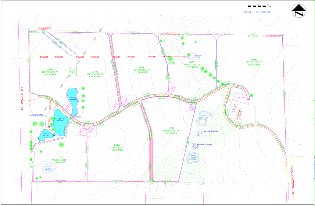
4: Proposed Subdivision Plan including Roadway, Grading & Stormwater Management Plan
We developed a detailed subdivision and site plan for a land parcel along Highway using AutoCAD Civil 3D. The goal was to optimize lot divisions, roadway network, and drainage while ensuring compliance with local zoning regulations.
Challenges & Solutions:
- Efficient Land Utilization:
Designed well-organized lot divisions to maximize space and ensure efficient use of the land. - Drainage & Infrastructure Planning:
Implemented a robust drainage system, effectively preventing waterlogging and ensuring proper runoff management. - Zoning & Regulatory Compliance:
Carefully ensured that all designs adhered to local zoning and development regulations, facilitating smooth approval processes.
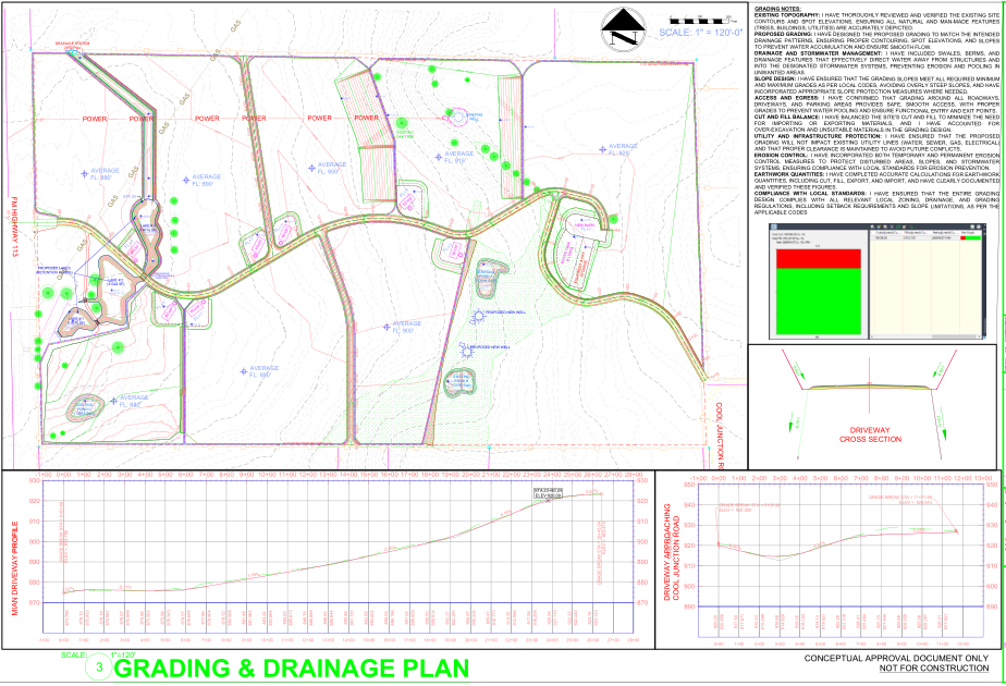
For the grading and drainage plan, we designed an efficient grading strategy that ensured proper slope and elevation across the site to direct water flow away from key structures. The drainage system was meticulously planned to prevent waterlogging and flooding, incorporating stormwater management solutions such as retention ponds and storm drains, ensuring effective water runoff and compliance with local environmental regulations. This comprehensive approach helped create a stable and sustainable site, ready for construction.
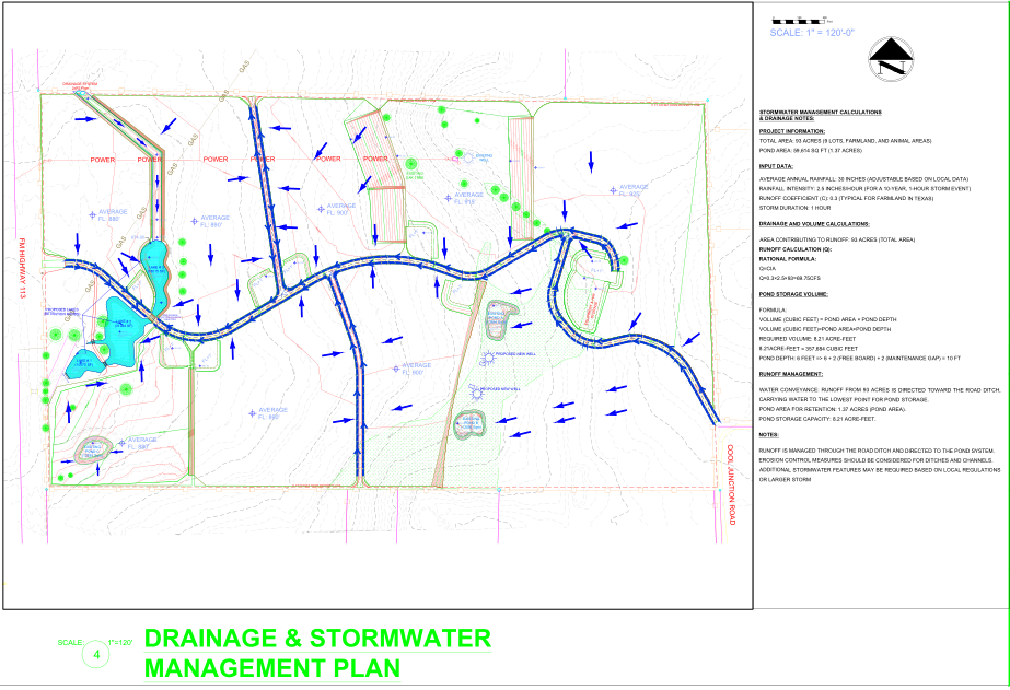
For the stormwater management system, we utilized AutoCAD Civil 3D to design an integrated solution that effectively manages surface runoff. This included the placement of storm drains, retention ponds, and swales to control water flow and minimize the risk of flooding. Using Civil 3D’s grading tools, I optimized the site’s topography to ensure proper drainage and water retention. The design also complied with local regulations for stormwater management, ensuring the system was both efficient and sustainable, while being fully integrated into the site plan for easy implementation during construction.
5: California Apartment Complex – 3D Modeling & Floor Plans
This project is a modern apartment building designed for a client in California, USA. The design incorporates a functional layout, optimized space utilization, and modern aesthetics to create a comfortable living environment.
Key Features:
🔹 Comprehensive Floor Plans
The project includes detailed floor plans for all levels, ensuring efficient space planning and practical functionality. The floors are structured as follows:
- Ground Floor: Living areas, kitchen, bedrooms, bathrooms, and an open-to-sky space for ventilation.
- First Floor: Additional bedrooms, common areas, and balcony access.
- Second Floor: Private living spaces with access to a rooftop terrace.
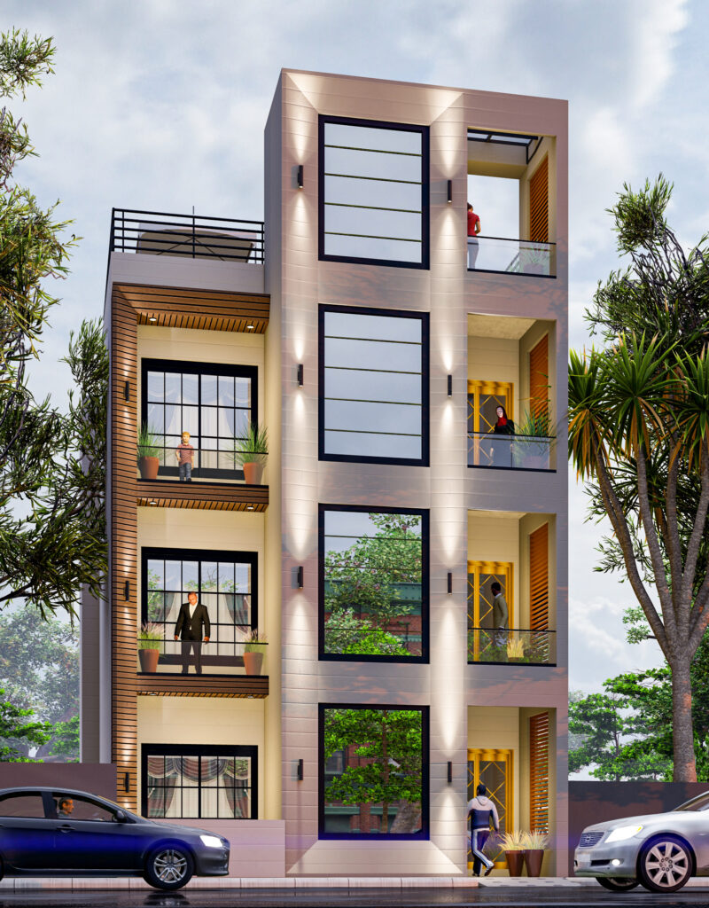
🔹 3D Modeling & Visualization
The apartment design was brought to life with high-quality 3D modeling and rendering, providing a realistic representation of the final structure. The 3D visuals help clients and stakeholders visualize the spatial arrangement and design aesthetics before construction.
🔹 Functional & Aesthetic Design
The design prioritizes natural lighting, ventilation, and efficient use of space, making it ideal for modern urban living. Key highlights include:
- Spacious living rooms for enhanced comfort.
- Well-ventilated bedrooms with large windows.
- Optimized kitchen layout for maximum functionality.
- Stylish bathroom designs with modern fittings.
- Dedicated laundry area for convenience.
🔹 Software & Tools Used
To ensure precision and quality, the project was designed using AutoCAD Civil 3D, Revit, and SketchUp. These tools enabled accurate floor planning, structural detailing, and realistic 3D visualization.
Why This Project Stands Out?
✅ Designed for modern urban living with practical space planning.
✅ Realistic 3D renderings to visualize the final construction.
✅ Efficient use of space ensuring comfort and functionality.
✅ Comprehensive floor plans tailored to the client’s needs.
This project is a great example of how thoughtful design, advanced technology, and detailed planning can create a stunning and functional residential space.
6: Full Grounds Map for Guests
I recently completed a detailed site mapping project for a Full Grounds Map for Guests, designed to optimize visitor experience through precise navigation, safety, and accessibility. Using AutoCAD Civil 3D, this project ensures accurate layout representation, making it easier for guests to find key locations efficiently.
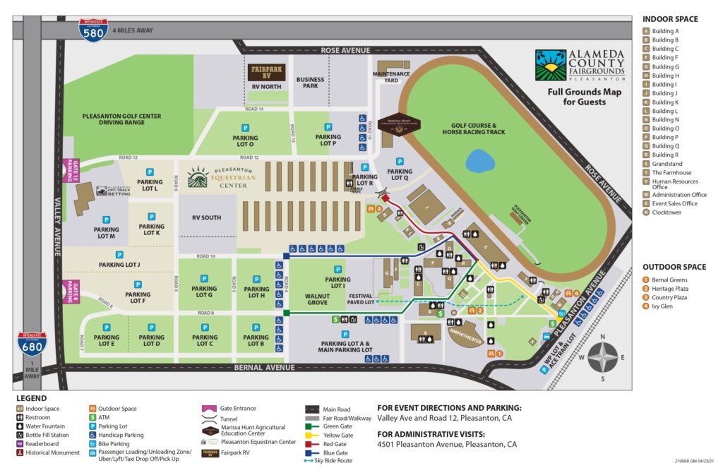
Project Highlights:
✔ Comprehensive Site Layout – Includes pathways, entry points, facilities, and important landmarks.
✔ Optimized Guest Navigation – Designed for seamless movement, reducing confusion and improving user experience.
✔ Infrastructure Integration – Incorporates roads, walkways, and public access areas for a well-structured layout.
✔ Accurate Scaling & Positioning – Ensures every element aligns perfectly with real-world conditions.
✔ Enhanced Safety & Accessibility – Provides clear directions to key areas, improving crowd management.
This map serves as a crucial tool for event planning, visitor management, and site accessibility, ensuring an organized and efficient experience for all guests.
What do you think about the importance of detailed site mapping in large venues? Share your thoughts!
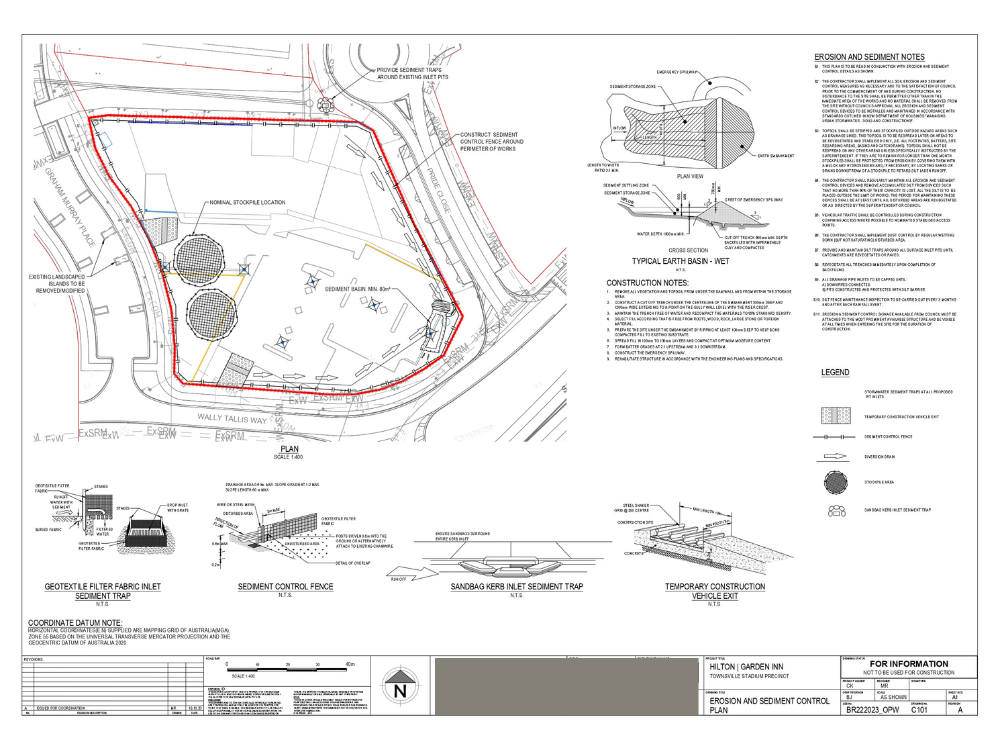
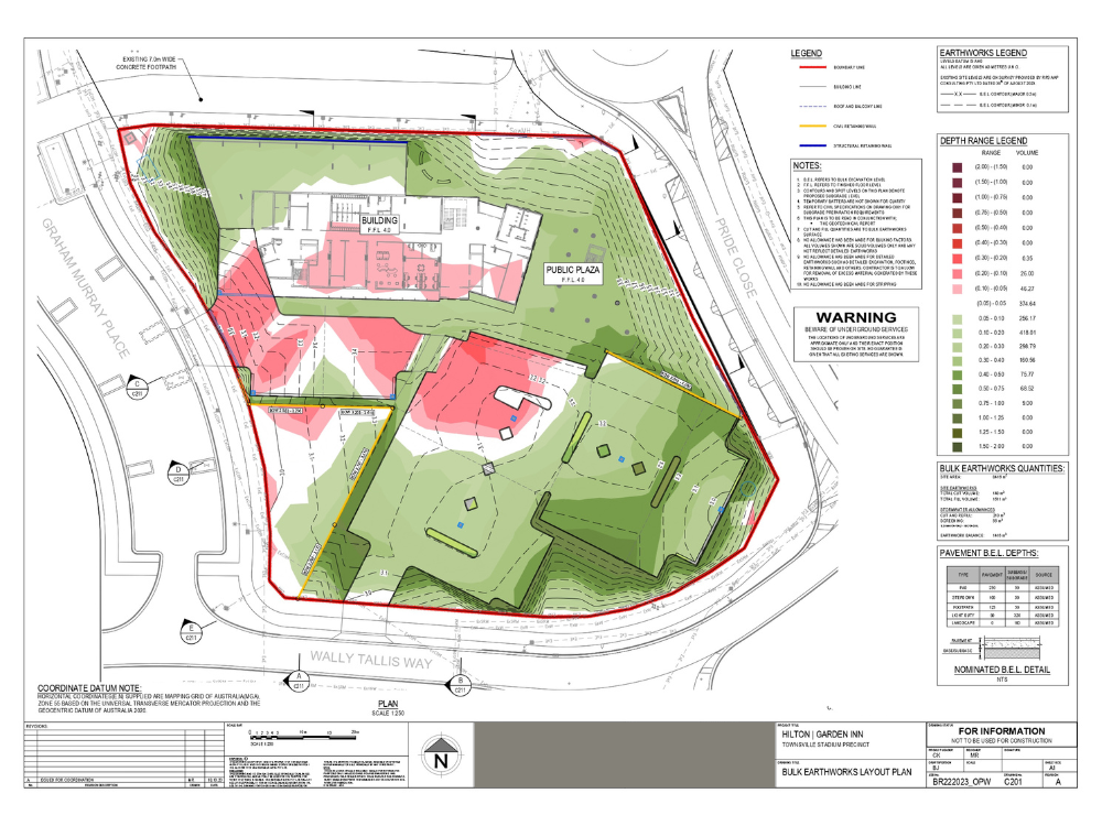
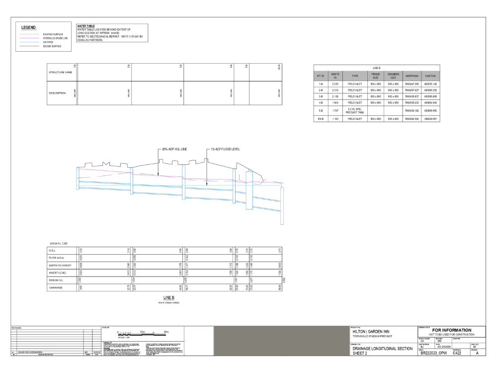
7: Civil 3D Project – Drainage, Pavement & Site Development Plans
This project showcases a detailed Civil 3D design, including drainage networks, pavement layouts, and site development plans. Each sheet represents a crucial aspect of the project, ensuring proper water management, road infrastructure, and site optimization.
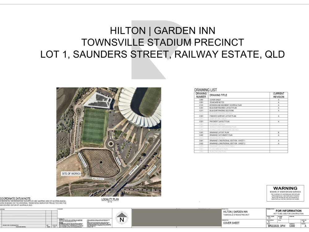
Location Plan
The location plan provides an overview of the project’s exact positioning within its surroundings. It highlights access roads, nearby infrastructure, and important reference points, making it essential for site selection and project approvals
Site Plan
The site plan provides a detailed overview of the project layout, including property boundaries, roads, utilities, and key site features. It serves as a fundamental guide for site development and infrastructure planning.
Proposed Site Plan
The proposed site plan displays the overall development layout, including buildings, roads, and utility connections. A key reference for project approvals and construction execution, ensuring efficient land use planning.
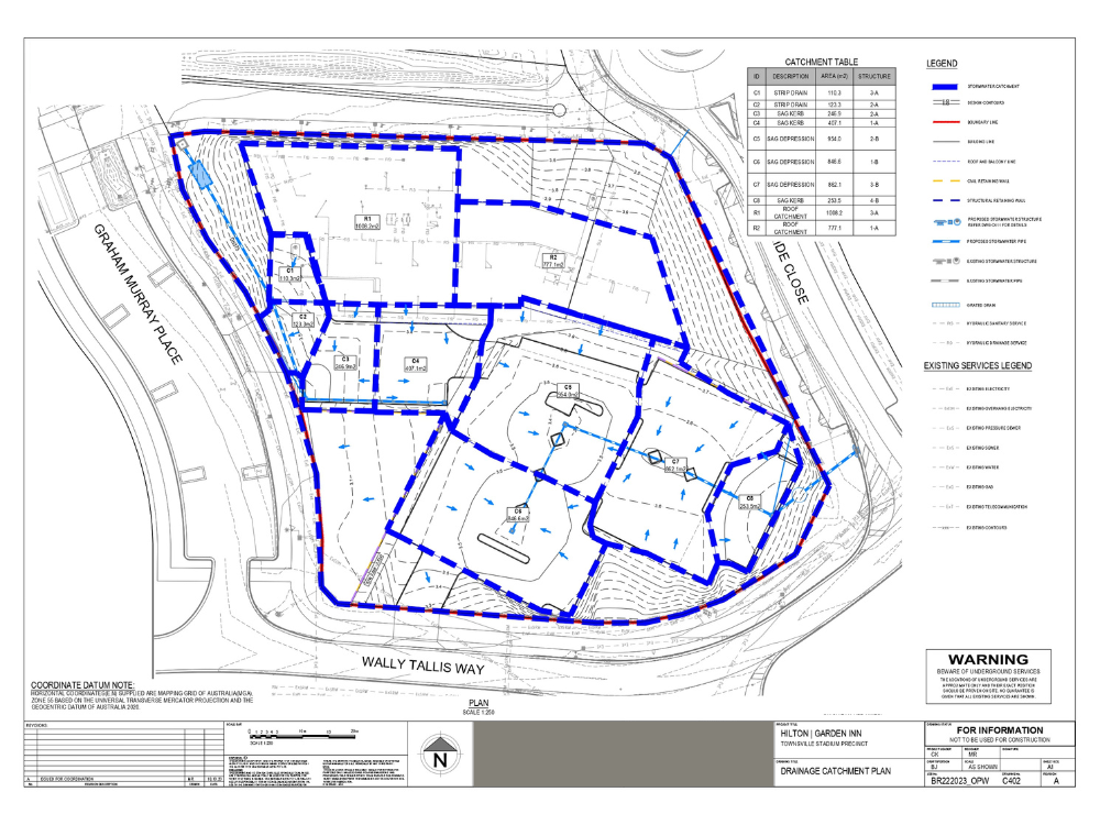
Drainage Catchment Plan
This plan defines the drainage catchment areas of the proposed site, illustrating the natural and designed water flow. It includes hydrological analysis to ensure efficient stormwater management. Proper catchment planning minimizes flooding risks and improves sustainability.
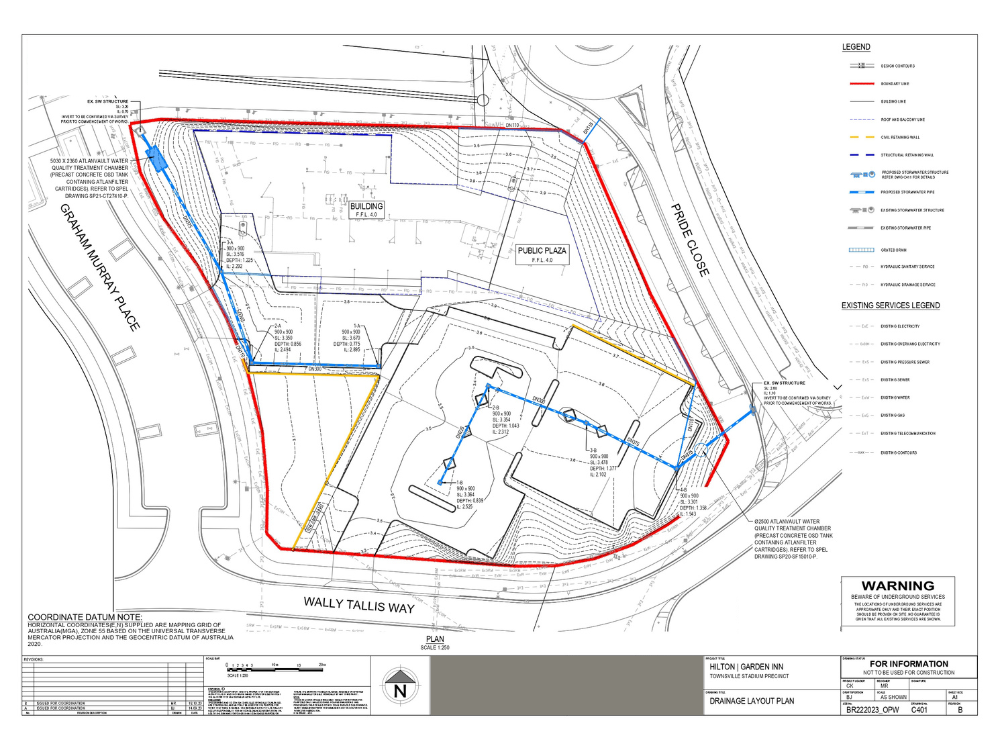
Drainage Layout Plan
The drainage layout plan presents the complete stormwater drainage network, including pipelines, inlets, and outlets. Designed to optimize water flow and prevent waterlogging, this plan adheres to engineering standards for a well-functioning drainage system.
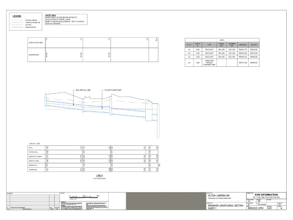
Drainage Profiles
These profile drawings detail the vertical alignment of drainage pipes and channels. They ensure gravity flow and hydraulic efficiency by maintaining proper elevations and slopes, making the drainage system effective and long-lasting.
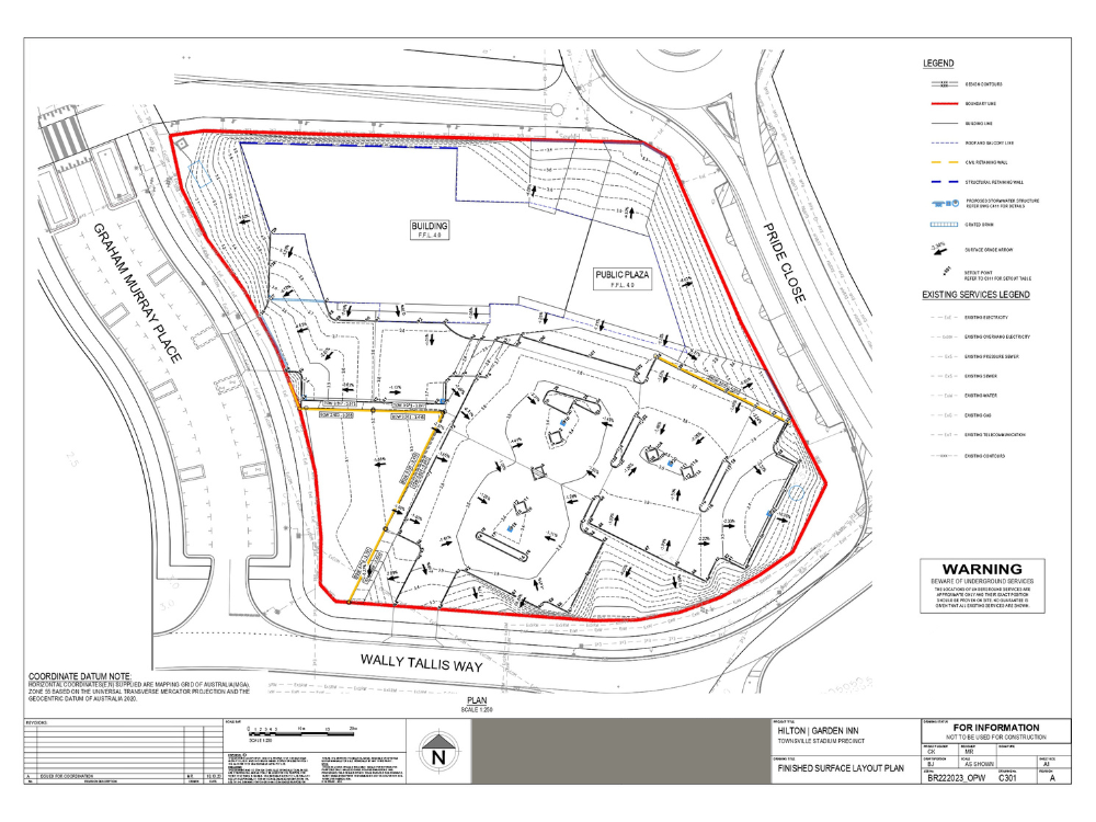
Finished Surface Layout Plan
This plan defines the final surface levels and grading patterns of the site. It ensures proper slopes and elevations for roads and pavements to facilitate smooth drainage and site accessibility. A critical reference for construction and land development.
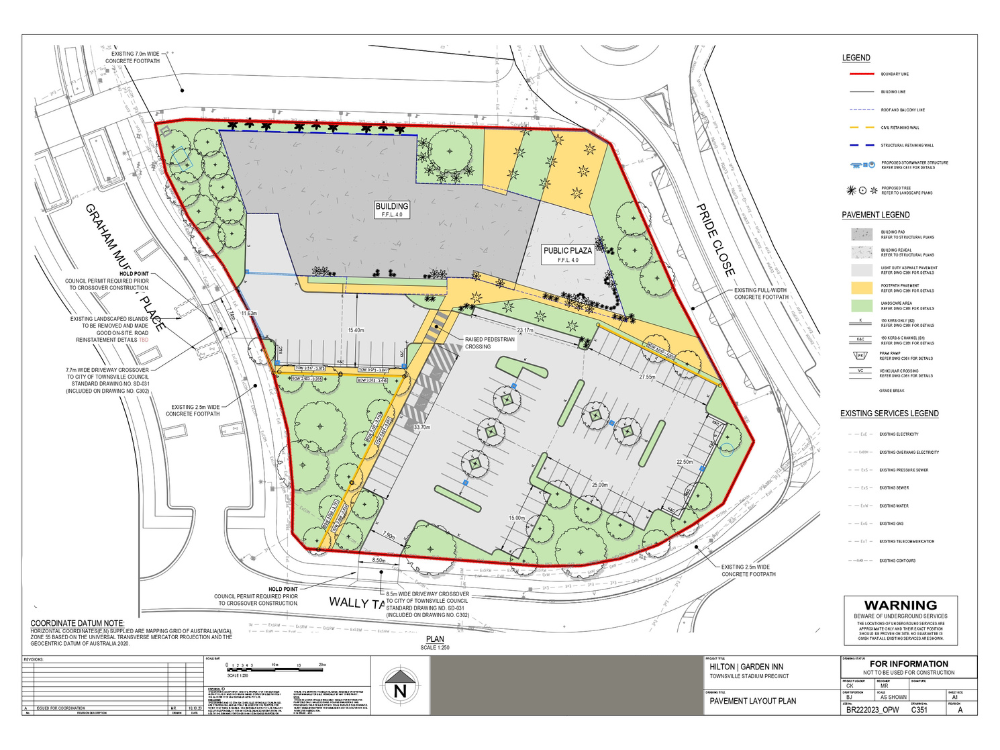
Pavement Layout Plan
This pavement layout plan outlines the structural design of roads and footpaths. It ensures proper material selection and thickness to support traffic loads, enhancing road durability and reducing maintenance needs.
Pipe Network Profile
This profile drawing presents the underground pipe network’s depth, slope, and connection points. Designed for optimal hydraulic efficiency, it ensures smooth water flow and proper maintenance access throughout the network.
Need professional Civil 3D design and land development services? Contact us today!
8: MIRADA – Complete Land Development Master Plan
MIRADA is a comprehensive residential land development master plan designed and delivered by our expert team at Civil Designs. Executed for a U.S.-based real estate developer via a freelancing platform, this project involved the complete planning of a modern housing community from scratch.
Our scope included:
- Road Network Design using AutoCAD Civil 3D
- Residential Plotting & Zoning with optimized layouts
- Green Spaces, Pools, Ponds, and Community Zones
- Grading Plans, Stormwater Drainage, and Utility Corridors
- 3D Visualizations using SketchUp and Lumion
- Final CAD documentation delivered in DWG & PDF formats
Client satisfaction was exceptional — visible through their 5-star feedback and praise for our technical expertise and communication.
👉 Delivered via Freelancing Platform | Client Feedback Visible on Project Image
9: Residential Subdivision Civil Engineering Design – Northway at Sallie Gabriel, Catawba County, North Carolina
Northway at Sallie Gabriel is a large-scale residential subdivision development project in Catawba County, North Carolina, designed to meet local authority and US civil engineering standards. The project includes complete site development, grading, drainage, stormwater management, roadway, utility, and landscape coordination, delivering approval-ready and construction-ready civil engineering plans for residential land development.
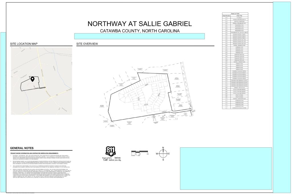
Cover Sheet
Provides an overall summary of the residential subdivision, including project location, design scope, and coordination details.
Sets the foundation for a complete civil engineering and site development design package.
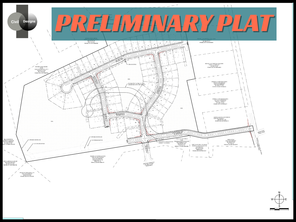
Preliminary Plat / Subdivision Layout
Shows the overall subdivision layout with lot lines, internal roads, access points, and open spaces. Designed to optimize land use while meeting local subdivision and zoning requirements.
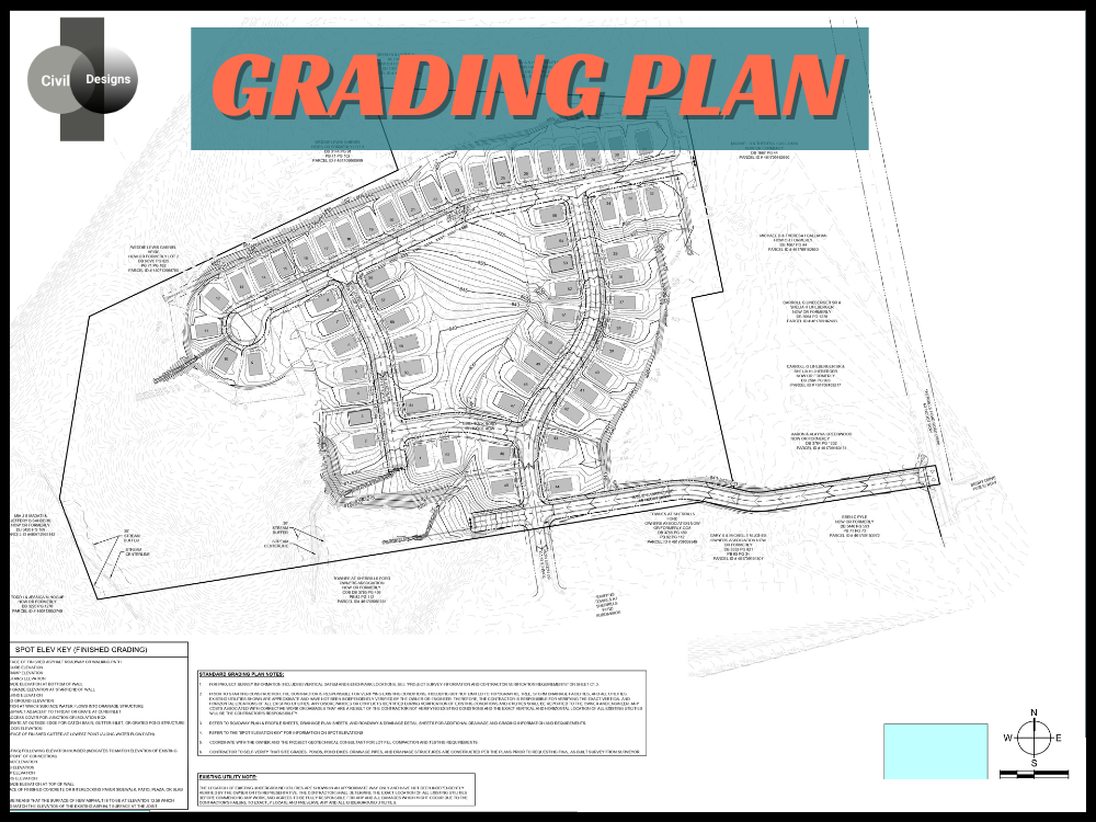
Grading Plan
Defines proposed elevations, slopes, and lot grading to ensure proper drainage and buildable lots. Grading is optimized to balance cut and fill and reduce construction costs.
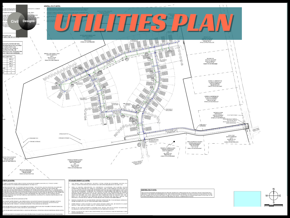
Utilities Plan
Illustrates coordinated layouts for water, sewer, and utility infrastructure across the site. Utilities are aligned with grading and road profiles to avoid conflicts and support efficient construction.
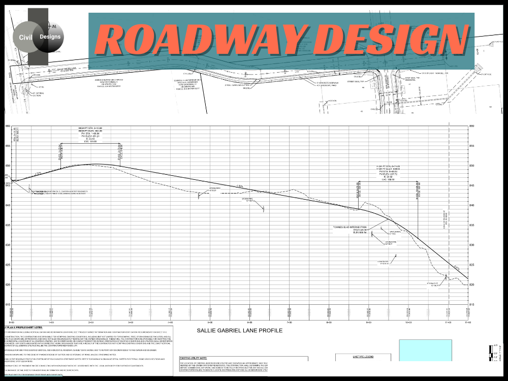
Roadway Design
Details internal road alignment, profiles, and circulation within the subdivision. Roads are designed to meet local standards while ensuring safe and efficient residential access.
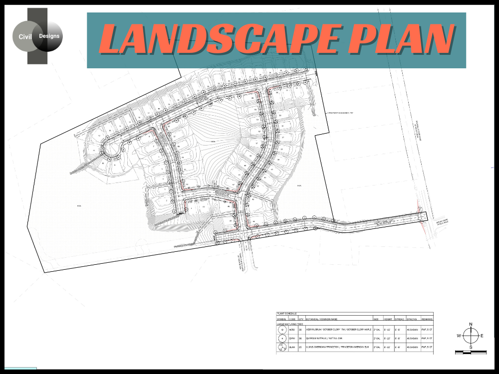
Landscape Plan
Highlights landscaped areas and open spaces integrated with site grading and drainage. Enhances site aesthetics while supporting stormwater flow and environmental compliance.